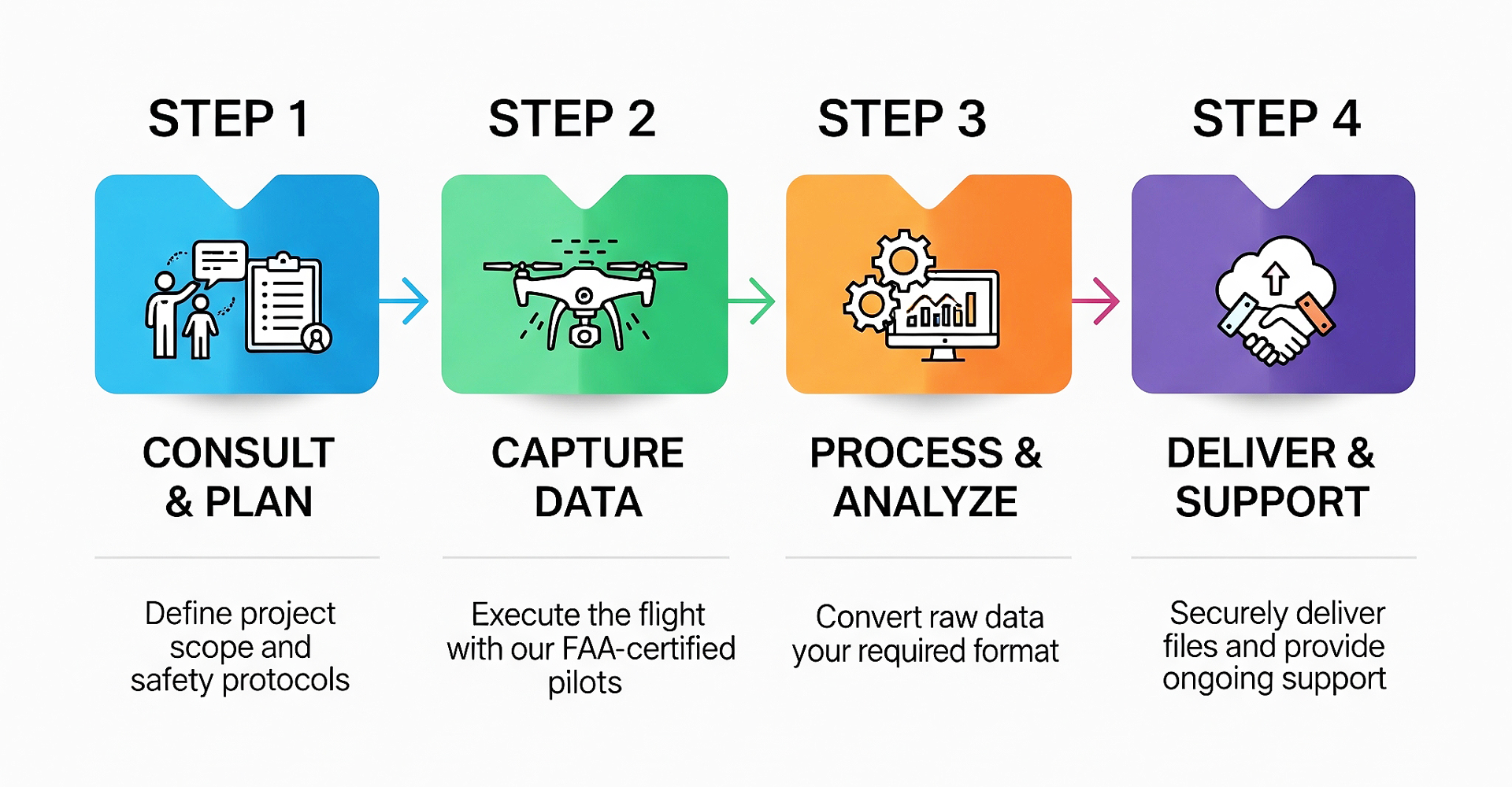
Transforming Your Site with Advanced Aerial Data

Our drone mapping service uses advanced aerial technology to create precise 2D maps and 3D models of your site. This modern method improves project safety, reduces site time, delivers significant cost savings, and provides the highly accurate data your team needs to make confident decisions.

From Raw Data to Actionable Insights

  • Orthomosaic Maps: High-resolution, distortion-free aerial images of your site.
  • 3D Topographic Maps: Detailed elevation models and contour lines for precise land analysis.
  • 3D Point Clouds & Models: Create interactive 3D replicas of your site for visualization and planning.
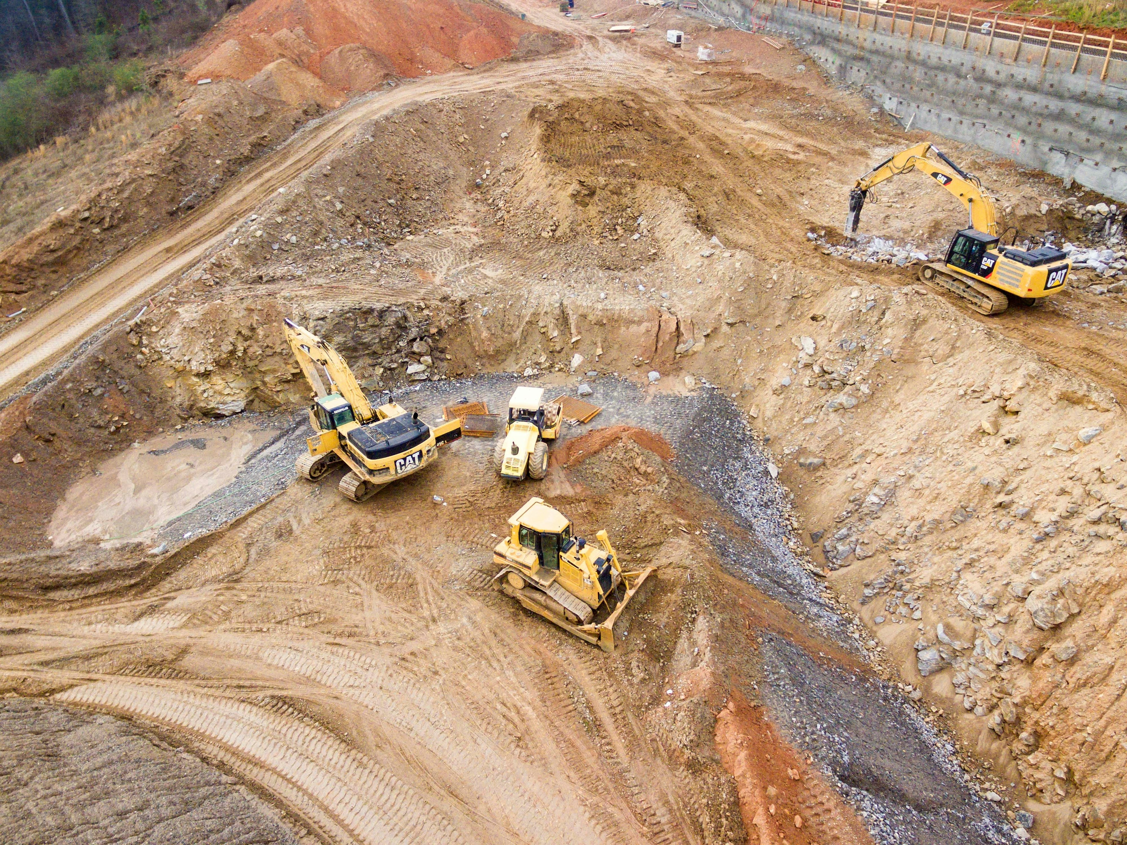
  • Volumetric Calculations: Accurately measure stockpiles, cut-and-fill volumes, and earthworks progress.

Customized Mapping for Your Industry

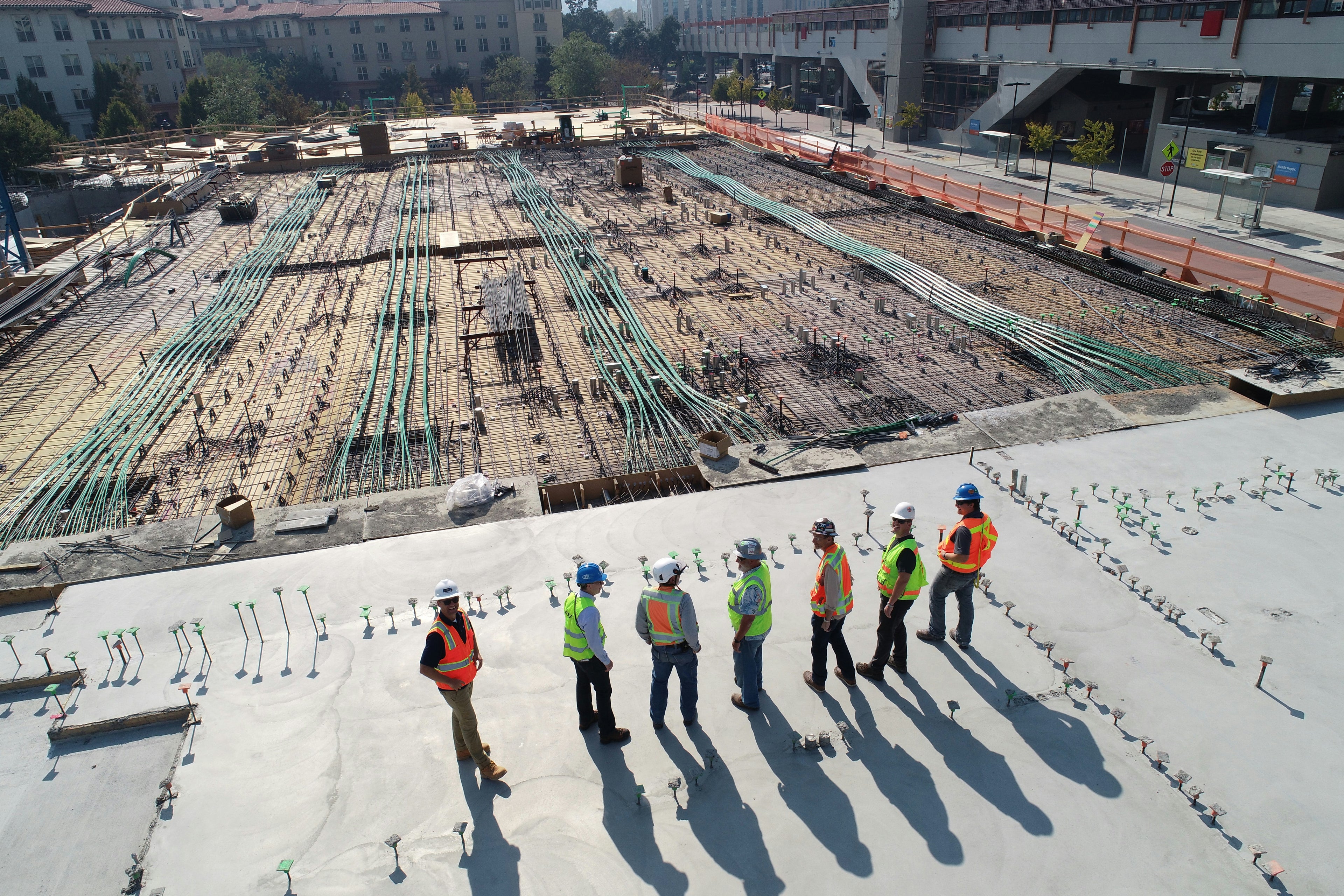
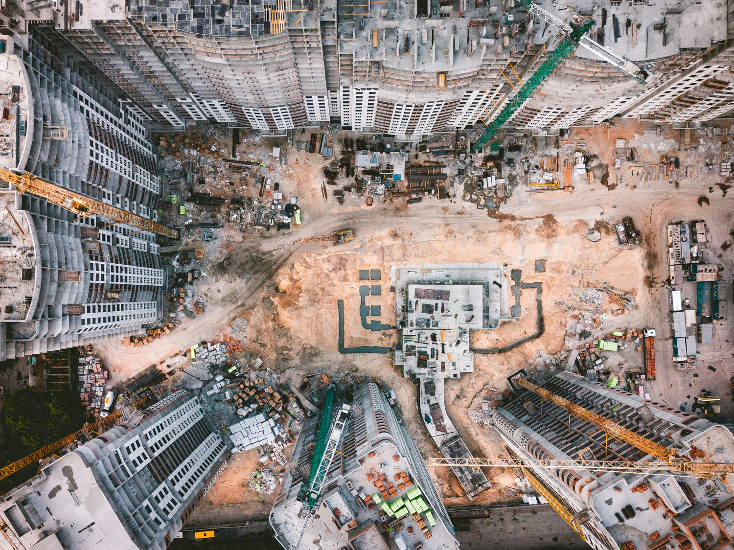
Construction & Engineering: Site progress monitoring, as-built verification, and cut-and-fill analysis.

Land Development: Site selection analysis, preliminary measurements, and infrastructure planning.

Environmental & Landfills: Monitoring changes over time, erosion control, and volume reporting.

Aggregates & Mining: Stockpile management and quarry volumetric analysis.

Precision You Can Depend On

We leverage state-of-the-art technology to guarantee the highest level of accuracy on every project. Our fleet includes survey-grade RTK/PPK-enabled drones for exceptional geospatial precision, complemented by advanced LiDAR sensors for capturing detailed data in complex environments.

To process this information, we utilize powerful, industry-standard software, including PIX4Dmapper and DJI Terra Pro, to transform raw data into polished and actionable deliverables. This combination ensures we deliver reliable, high-precision data you can trust for your most critical projects.

See Our Mapping in Action
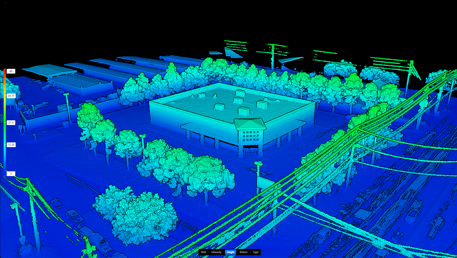
Mapping In Action


This project showcases our ability to create intricate 3D digital maps, providing a comprehensive and measurable representation of a site and its surrounding infrastructure.
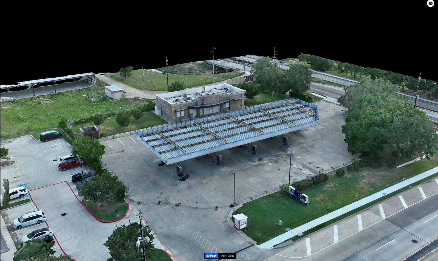
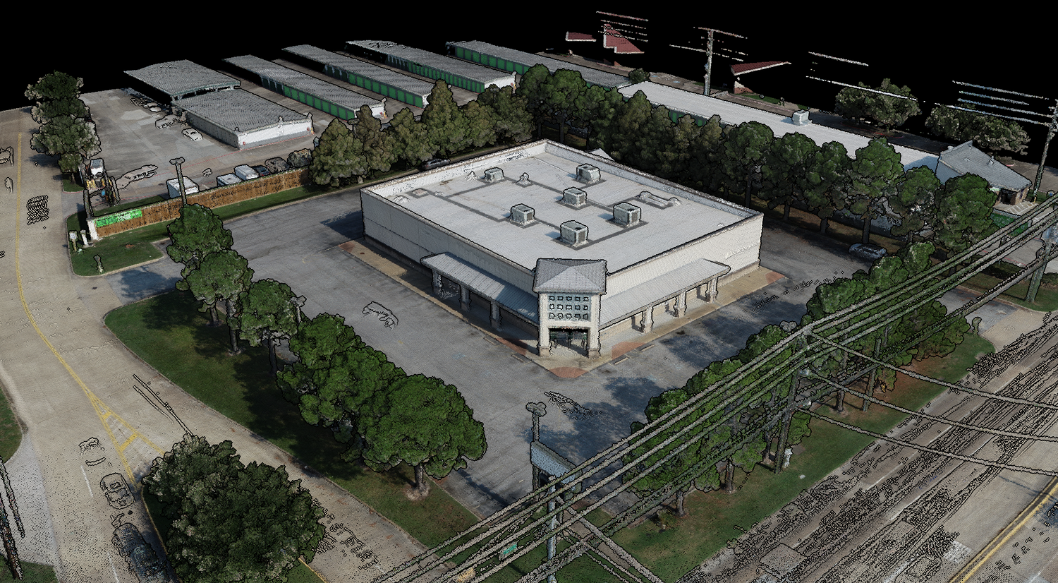
View Project

Caption

Lifelike 3D Models

This detailed 3D model showcases our ability to create a precise digital twin of any commercial property, giving you a comprehensive and measurable aerial perspective for inspections, marketing, and planning.
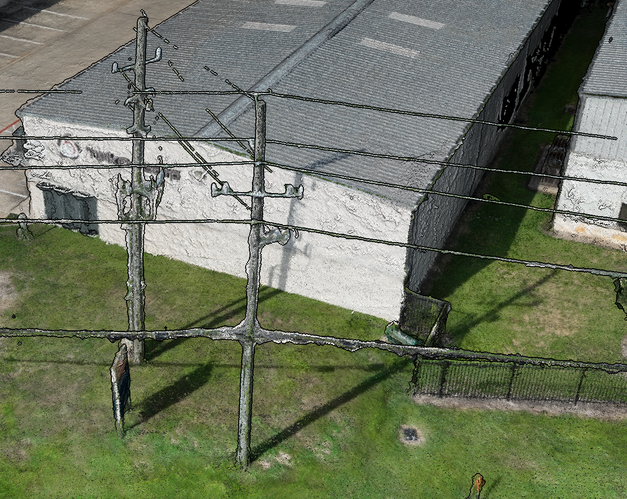
View Project

LiDAR Precision

Leveraging advanced LiDAR technology, we create remarkably precise and detailed 3D models of complex environments. Unlike photogrammetry, LiDAR excels at accurately capturing intricate features like utility wires and fences, providing a dense, measurable dataset even in challenging conditions. This level of detail is essential for critical infrastructure inspections, site analysis, and planning.

View Project

Common Questions About Drone Mapping

What file formats can you deliver?

We deliver data in a wide variety of industry-standard formats to ensure seamless integration with your existing software (like AutoCAD, Civil 3D, ArcGIS, etc.). Common formats include:

  • For Orthomosaic Maps: GeoTIFF, KML, JPG
  • For 3D Point Clouds: .LAS, .LAZ
  • For 3D Models: .OBJ, .DWG, .DXF
  • For Contour & Topographic Data: .SHP, .DXF

If you have a specific file requirement, let us know and we will be happy to accommodate it.

How long does the process take?

The project timeline depends on the size and complexity of the site. However, for a standard project:

  • On-Site Data Capture: Typically completed within a few hours to one full business day.
  • Data Processing & Delivery: Usually takes between 2 to 5 business days after the flight.

We will provide a precise delivery schedule with your project quote.

Are your pilots certified and insured?

Absolutely. All of our pilots are certified by the Federal Aviation Administration (FAA) under Part 107, which is the federal requirement for professional commercial drone operations. Additionally, Space City Drones is fully insured with comprehensive liability coverage for your complete peace of mind.